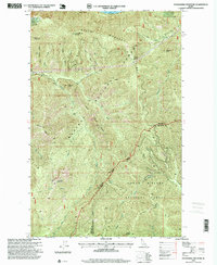
1996 Map of Packsaddle Mountain
USGS Topo · Published 1999About this map
Kaniksu National Forest and Coeur d'Alene National Forest meet in this 1990s survey, marking a rugged intersection of Northern Idaho's wilderness. The landscape is defined by the significant elevation of Packsaddle Mountain and the prominent Green Monarch Mountain, which looms over the southeastern reaches of Lake Pend Oreille. This map documents a region dominated by steep timberlands and mineral potential, specifically evidenced by the Green Monarch Mine situated near the lake's edge.
Find a feature on this map
32 named features on this map. Tap any name to fly to it.
Don’t see what you’re looking for? This feature index may not catch every label — zoom into the map to look around manually.
Map Details
Editions of this 1996 Packsaddle Mountain Map
This is the sole edition of this map. No revisions or reprints were ever made.
Other maps of this area

1909 · Cataldo
USGS Topo · 1:125,000

1911 · Cataldo
USGS Topo · 1:125,000

1911 · Priest Lake
USGS Topo · 1:250,000

1913 · Priest Lake
USGS Topo · 1:250,000

1949 · Packsaddle Mtn
USGS Topo · 1:62,500

1951 · Packsaddle Mtn
USGS Topo · 1:62,500

1951 · Clark Fork
USGS Topo · 1:62,500

1955 · Spokane
USGS Topo · 1:250,000

1958 · Spokane
USGS Topo · 1:250,000

1958 · Sandpoint
USGS Topo · 1:250,000