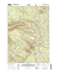
2017 Map of Packsaddle Mountain
USGS Topo · Published 2017About this map
The high divide between Lane and Deschutes counties is defined here by the Cascade Range, where the headwaters of the S Fork McKenzie River descend from a cluster of mountain lakes. This 2017 survey captures a remote wilderness landscape dominated by the Willamette National Forest and Deschutes National Forest. The Pacific Crest National Scenic Trail winds through the southern portion of the map, passing below Little Roundtop Mtn and near Winopee Lake. To the north, the Mink Lake Basin reveals a high density of water bodies, including Goose Lake, Porky Lake, and Mink Lake. Historically significant meadows and camps like Shroy Meadows and Corral Flat are interspersed among peaks such as Packsaddle Mtn and Horse Mtn, while Wildcat Swamp and Bill Gott Spring mark the hydrology of the western slopes.
Find a feature on this map
98 named features on this map. Tap any name to fly to it.
Don’t see what you’re looking for? This feature index may not catch every label — zoom into the map to look around manually.
Map Details
Editions of this 2017 Packsaddle Mountain Map
This is the sole edition of this map. No revisions or reprints were ever made.
Other maps of this area

1925 · Waldo Lake
USGS Topo · 1:125,000

1929 · Three Sisters
USGS Topo · 1:125,000

1930 · Maiden Peak
USGS Topo · 1:125,000

1932 · Three Sisters
USGS Topo · 1:125,000

1934 · Maiden Peak
USGS Topo · 1:125,000

1934 · Mc Kenzie Bridge
USGS Topo · 1:96,000

1940 · Mc Kenzie Bridge
USGS Topo · 1:125,000

1953 · Salem
USGS Topo · 1:250,000

1954 · Salem
USGS Topo · 1:250,000

1955 · Chucksney Mtn
USGS Topo · 1:62,500