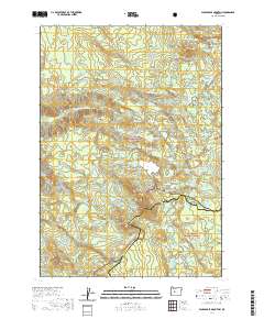
2020 Map of Packsaddle Mountain
USGS Topo · Published 2020About this map
Packsaddle Mtn stands as a central landmark in this high-altitude landscape where the Willamette National Forest meets the Deschutes National Forest. The 2020 survey details a region defined by an intricate network of alpine hydrology, where the S Fork McKenzie River and Elk Creek are fed by numerous small bodies of water like Junction Lake, Martin Lake, and Mud Lake. The presence of the Pacific Crest National Scenic Trail winding through the center of the map indicates the area's importance for long-distance transit through the Cascade Range. Notable meadows and flats, such as Shroy Meadows and Corral Flat, suggest the historical use of these high clearings amidst the timber. The boundary between Lane Co and Deschutes Co bisects the quadrangle, illustrating how these mountain summits serve as natural political divisions.
Find a feature on this map
92 named features on this map. Tap any name to fly to it.
Don’t see what you’re looking for? This feature index may not catch every label — zoom into the map to look around manually.
Map Details
Editions of this 2020 Packsaddle Mountain Map
This is the sole edition of this map. No revisions or reprints were ever made.
Other maps of this area

1925 · Waldo Lake
USGS Topo · 1:125,000

1929 · Three Sisters
USGS Topo · 1:125,000

1930 · Maiden Peak
USGS Topo · 1:125,000

1932 · Three Sisters
USGS Topo · 1:125,000

1934 · Maiden Peak
USGS Topo · 1:125,000

1934 · Mc Kenzie Bridge
USGS Topo · 1:96,000

1940 · Mc Kenzie Bridge
USGS Topo · 1:125,000

1953 · Salem
USGS Topo · 1:250,000

1954 · Salem
USGS Topo · 1:250,000

1955 · Chucksney Mtn
USGS Topo · 1:62,500