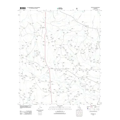
2012 Map of Packton
USGS Topo · Published 2012About this map
The Dugdemona River forms the northeastern boundary of this landscape, where the small communities of Packton, Moore, and New Moore are connected by a network of rural roads and forest service routes. Settled within this corner of Winn Parish, the area is defined by its many small cemeteries, including Melton Cem, Pleasant Hill Cem, Jordan Hill Cem, and Corinth Cem, which serve as vital markers for local family histories. The terrain is crisscrossed by numerous drainages such as Big Cr, Bear Cr, and Little Bear Cr, indicating a low-lying, well-watered timberland. In the northwestern corner, the Latt Lookout Tower stands as a notable landmark overlooking the intersection of Huey Melton Rd and Melton Cemetary Rd, reflecting the region's managed forest heritage and the influence of family-named roads like Lynn Melton and Manuel Long Rd on the local map.
Find a feature on this map
54 named features on this map. Tap any name to fly to it.
Don’t see what you’re looking for? This feature index may not catch every label — zoom into the map to look around manually.
Map Details
Editions of this 2012 Packton Map
This is the sole edition of this map. No revisions or reprints were ever made.
Other maps of this area

1932 · Colfax NE
USGS Topo · 1:31,680

1932 · Colfax NW
USGS Topo · 1:31,680

1936 · Colfax
USGS Topo · 1:62,500

1936 · Pollock
USGS Topo · 1:62,500

1941 · Pollock
USGS Topo · 1:62,500

1950 · Winnfield
USGS Topo · 1:62,500

1951 · Winnfield
USGS Topo · 1:62,500

1953 · Alexandria
USGS Topo · 1:250,000

1954 · Tullos
USGS Topo · 1:62,500

1955 · Alexandria
USGS Topo · 1:250,000