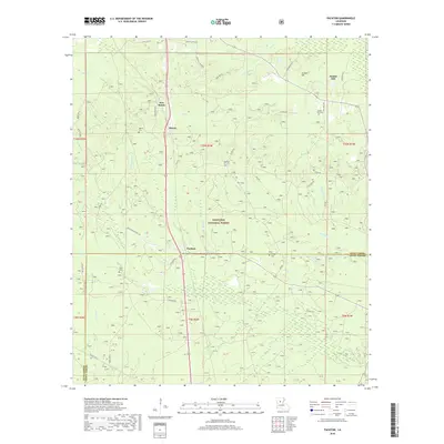
2018 Map of Packton
USGS Topo · Published 2018About this map
Kisatchie National Forest dominates the topography of this portion of central Louisiana, where the landscapes of Winn and Grant Parishes meet. The settlement pattern is defined by small communities such as Packton and Jordan Hill, connected by a network of rural routes like Packton-Alexandria Rd and Iron Bridge Rd. For family researchers, the map provides precise locations for several burial grounds, including Jordan Hill Cem, Pleasant Hill Cem, and Melton Cem. Numerous small waterways, including Little Bear Cr, Caskie Br, and Big Cr, drain the forested terrain. The map's layout of section lines and parish boundaries illustrates the local administrative geography of this timber-rich region, anchored by the long-established presence of the Moore and New Moore settlements.
Find a feature on this map
56 named features on this map. Tap any name to fly to it.
Don’t see what you’re looking for? This feature index may not catch every label — zoom into the map to look around manually.
Map Details
Editions of this 2018 Packton Map
This is the sole edition of this map. No revisions or reprints were ever made.
Other maps of this area

1932 · Colfax NE
USGS Topo · 1:31,680

1932 · Colfax NW
USGS Topo · 1:31,680

1936 · Colfax
USGS Topo · 1:62,500

1936 · Pollock
USGS Topo · 1:62,500

1941 · Pollock
USGS Topo · 1:62,500

1950 · Winnfield
USGS Topo · 1:62,500

1951 · Winnfield
USGS Topo · 1:62,500

1953 · Alexandria
USGS Topo · 1:250,000

1954 · Tullos
USGS Topo · 1:62,500

1955 · Alexandria
USGS Topo · 1:250,000