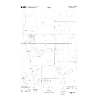
2013 Map of Paddock Lake
USGS Topo · Published 2013About this map
The Des Plaines River and Brighton Cr thread through this portion of Kenosha County, defining a landscape marked by a dense concentration of glacial lakes and small airfields. This 2013 survey illustrates the residential growth surrounding Paddock Lake and Lake Shangrila, while traditional crossroads like Salem and Bristol anchor the local road network. To the north, the Union League Boys Camp sits near League Lake, while the agricultural character of the region is evident in the presence of private flight strips such as Chilcott Farms Airport and Bristol Airport. The eastern edge is touched by the Root River, contrasting with the western reach where Trevor and Liberty Corners mark the transitions between wetlands and prairie. The map provides a look at the modern balance between recreational lake living and the infrastructure of a rural-suburban corridor.
Find a feature on this map
78 named features on this map. Tap any name to fly to it.
Don’t see what you’re looking for? This feature index may not catch every label — zoom into the map to look around manually.
Map Details
Editions of this 2013 Paddock Lake Map
This is the sole edition of this map. No revisions or reprints were ever made.
Other maps of this area

1892 · Racine
USGS Topo · 1:62,500

1893 · Silver Lake
USGS Topo · 1:62,500

1905 · Racine
USGS Topo · 1:62,500

1906 · Silver Lake
USGS Topo · 1:62,500

1906 · Waukegan
USGS Topo · 1:62,500

1908 · Waukegan
USGS Topo · 1:62,500

1920 · Grays Lake
USGS Topo · 1:62,500

1923 · Grays Lake
USGS Topo · 1:62,500

1954 · Rockford
USGS Topo · 1:250,000

1955 · Rockford
USGS Topo · 1:250,000