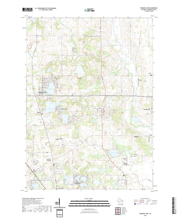
2022 Map of Paddock Lake
USGS Topo · Published 2022About this map
The Des Plaines River and the Root River thread through this corner of Kenosha County, defining a landscape shaped by glacial depressions and early Wisconsin settlement. Centered on the growing community of Paddock Lake, the map reveals a high density of water bodies including Hooker Lake, George Lake, and Lake Shangrila. These lakes historically drove local development, supporting both seasonal recreation and permanent hamlets such as Salem Oaks and Salem Lakes.
Find a feature on this map
48 named features on this map. Tap any name to fly to it.
Don’t see what you’re looking for? This feature index may not catch every label — zoom into the map to look around manually.
Map Details
Editions of this 2022 Paddock Lake Map
This is the sole edition of this map. No revisions or reprints were ever made.
Other maps of this area

1892 · Racine
USGS Topo · 1:62,500

1893 · Silver Lake
USGS Topo · 1:62,500

1905 · Racine
USGS Topo · 1:62,500

1906 · Silver Lake
USGS Topo · 1:62,500

1906 · Waukegan
USGS Topo · 1:62,500

1908 · Waukegan
USGS Topo · 1:62,500

1920 · Grays Lake
USGS Topo · 1:62,500

1923 · Grays Lake
USGS Topo · 1:62,500

1954 · Rockford
USGS Topo · 1:250,000

1955 · Rockford
USGS Topo · 1:250,000