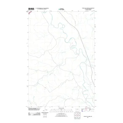
2011 Map of Paddy Fay Creek
USGS Topo · Published 2011About this map
The Tongue River meanders through this portion of Custer County, shaping a landscape defined by its complex drainage network. Tributaries like Paddy Fay Creek and North Woman Creek feed into the primary river valley, creating a topography of interconnected coulees and ridges characteristic of eastern Montana. Human presence is marked primarily by the transportation corridor of Cemetery Rd, which runs parallel to the river's path, and various local routes that follow the natural contours of the land.
Find a feature on this map
8 named features on this map. Tap any name to fly to it.
Don’t see what you’re looking for? This feature index may not catch every label — zoom into the map to look around manually.
Map Details
Editions of this 2011 Paddy Fay Creek Map
This is the sole edition of this map. No revisions or reprints were ever made.
Other maps of this area

1953 · Miles City
USGS Topo · 1:250,000

1957 · Miles City
USGS Topo · 1:250,000

1958 · Miles City
USGS Topo · 1:250,000

1968 · Big Hill
USGS Topo · 1:24,000

1968 · Miles City
USGS Topo · 1:24,000

1968 · Lignite Creek
USGS Topo · 1:24,000

1968 · Paddy Fay Creek
USGS Topo · 1:24,000
1969 · Jack Creek NW
USGS Topo · 1:24,000

1969 · Horse Creek
USGS Topo · 1:24,000

1969 · Circle L Creek
USGS Topo · 1:24,000