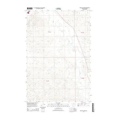
2014 Map of Paddy Fay Creek
USGS Topo · Published 2014About this map
The Tongue River valley defines the character of this Custer County landscape, winding northward through a series of wide oxbows and carved banks. This 2014 survey documents the hydrography of the region just before the mid-2010s, showing how seasonal drainages like Paddy Fay Cr and N Woman Cr feed into the main river system from the surrounding high ground. The map reflects a predominantly rural and agricultural layout, where the few named roads like Becker Ln and MT-59 provide the primary access to sprawling land tracts defined by the Public Land Survey System.
Find a feature on this map
14 named features on this map. Tap any name to fly to it.
Don’t see what you’re looking for? This feature index may not catch every label — zoom into the map to look around manually.
Map Details
Editions of this 2014 Paddy Fay Creek Map
This is the sole edition of this map. No revisions or reprints were ever made.
Other maps of this area

1953 · Miles City
USGS Topo · 1:250,000

1957 · Miles City
USGS Topo · 1:250,000

1958 · Miles City
USGS Topo · 1:250,000

1968 · Big Hill
USGS Topo · 1:24,000

1968 · Miles City
USGS Topo · 1:24,000

1968 · Lignite Creek
USGS Topo · 1:24,000

1968 · Paddy Fay Creek
USGS Topo · 1:24,000
1969 · Jack Creek NW
USGS Topo · 1:24,000

1969 · Horse Creek
USGS Topo · 1:24,000

1969 · Circle L Creek
USGS Topo · 1:24,000