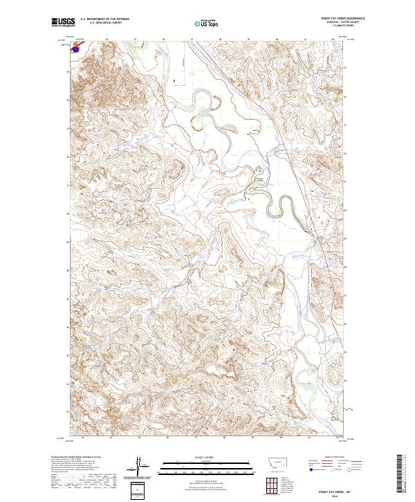
2024 Map of Paddy Fay Creek
USGS Topo · Published 2024About this map
The Tongue River meanders across this Custer County landscape, defining a valley carved through high-plains terrain. Central to the area's agricultural development is the Tongue and Yellowstone River Irrigation District Canal, which traces the eastern terrace of the river valley to manage water across these arid townships. The drainage network is dense with named coulees and intermittent streams, including Paddy Fay Creek, Cowles Creek, and Log Creek. While the uplands remain largely open and sparsely roaded, limited access points like Becker Ln and Rd 516 connect the valley floor to the surrounding heights. This mapping reflects the modern intersection of hydraulic engineering and the natural drainage patterns of southeastern Montana, where creek names like Mill Creek and Lignite Creek hint at the resources and activities that shaped local land use.
Find a feature on this map
14 named features on this map. Tap any name to fly to it.
Don’t see what you’re looking for? This feature index may not catch every label — zoom into the map to look around manually.
Map Details
Editions of this 2024 Paddy Fay Creek Map
This is the sole edition of this map. No revisions or reprints were ever made.
Other maps of this area

1953 · Miles City
USGS Topo · 1:250,000

1957 · Miles City
USGS Topo · 1:250,000

1958 · Miles City
USGS Topo · 1:250,000

1968 · Big Hill
USGS Topo · 1:24,000

1968 · Miles City
USGS Topo · 1:24,000

1968 · Lignite Creek
USGS Topo · 1:24,000

1968 · Paddy Fay Creek
USGS Topo · 1:24,000
1969 · Jack Creek NW
USGS Topo · 1:24,000

1969 · Horse Creek
USGS Topo · 1:24,000

1969 · Circle L Creek
USGS Topo · 1:24,000