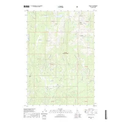
2020 Map of Paddy Flat
USGS Topo · Published 2020About this map
Paddy Flat serves as a central high-mountain basin within the Payette National Forest, surrounded by a dramatic ring of summits and alpine lakes. This 2020 survey details the complex network of forest access roads, such as Paddy Flat Rd and Rapid Creek Rd, which navigate the steep drainage systems of Kennally Cr and Rapid Cr. Significant geological landmarks including Jughandle Mtn, Twin Peaks, and Buckhorn Mtn dominate the horizon, while high-elevation water bodies like Boulder Lake and the Kennally Lakes indicate the glacial history of the landscape. Local roads like Homestead Rd and Ridgeview Rd suggest pockets of development or residential use amidst the timbered slopes. The map traces recreational and utility corridors, from the Shoreline Trail at the western edge to the power line paths crossing the eastern ridges.
Find a feature on this map
56 named features on this map. Tap any name to fly to it.
Don’t see what you’re looking for? This feature index may not catch every label — zoom into the map to look around manually.
Map Details
Editions of this 2020 Paddy Flat Map
This is the sole edition of this map. No revisions or reprints were ever made.
Other maps of this area

1911 · Meadows
USGS Topo · 1:125,000

1954 · Gold Fork
USGS Topo · 1:62,500

1954 · Cascade
USGS Topo · 1:62,500

1955 · Baker
USGS Topo · 1:250,000

1957 · Challis
USGS Topo · 1:250,000

1959 · Baker
USGS Topo · 1:250,000

1960 · Challis
USGS Topo · 1:250,000

1963 · Challis
USGS Topo · 1:250,000

1973 · Blackmare
USGS Topo · 1:24,000

1973 · Fitsum Peak
USGS Topo · 1:24,000