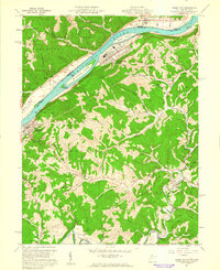
1960 Map of Paden City
USGS Topo · Published 1961About this map
The Ohio River corridor defines this 1960 landscape, serving as the industrial and transportation backbone for Paden City and Sistersville. Along the riverbanks, the Baltimore and Ohio railroad tracks follow the water's edge, passing Witten Towhead and Paden Island. The map records the infrastructure of the era, from the Waterworks and Sewage Disposal in Paden City to the numerous oil wells dotting the hillsides of Lincoln and Union districts.
Find a feature on this map
76 named features on this map. Tap any name to fly to it.
Don’t see what you’re looking for? This feature index may not catch every label — zoom into the map to look around manually.
Map Details
Editions of this 1960 Paden City Map
4 editions found
Other maps of this area

1905 · West Union
USGS Topo · 1:62,500

1905 · New Matamoras
USGS Topo · 1:62,500

1906 · Saint Marys
USGS Topo · 1:62,500

1906 · New Martinsville
USGS Topo · 1:62,500

1924 · St Marys
USGS Topo · 1:62,500

1924 · New Martinsville
USGS Topo · 1:62,500

1924 · New Matamoras
USGS Topo · 1:62,500

1924 · West Union
USGS Topo · 1:62,500

1926 · New Martinsville
USGS Topo · 1:62,500

1926 · New Matamoras
USGS Topo · 1:62,500