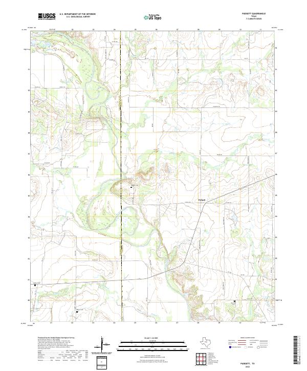
2022 Map of Padgett
USGS Topo · Published 2022About this map
The Brazos River carves a sweeping, meandering path through this rural landscape on the border of Throckmorton and Young counties. The small settlement of Padgett serves as a central point in an area defined by agricultural land and numerous winding waterways, including Bitter Cr and Camp Cr. This modern survey illustrates how long-established family names and early settlements persist through the naming of local landmarks and thoroughfares. Genealogists will find significant value in the distribution of several community burial sites, such as Padgett Cem and Keeter Cem, which are tucked away along county roads. The terrain is marked by the confluence of several tributaries, like Boggy Cr and Watson Cr, which flow into the main river channel, shaping the ranching and farming divisions of this North Texas region.
Find a feature on this map
51 named features on this map. Tap any name to fly to it.
Don’t see what you’re looking for? This feature index may not catch every label — zoom into the map to look around manually.
Map Details
Editions of this 2022 Padgett Map
This is the sole edition of this map. No revisions or reprints were ever made.
Other maps of this area

1954 · Wichita Falls
USGS Topo · 1:250,000

1958 · Wichita Falls
USGS Topo · 1:250,000

1963 · Megargel
USGS Topo · 1:24,000

1964 · Padgett
USGS Topo · 1:24,000
1964 · Lake Olney
USGS Topo · 1:24,000

1964 · Olney
USGS Topo · 1:24,000

1965 · Throckmorton NE
USGS Topo · 1:24,000

1966 · Westover SE
USGS Topo · 1:24,000
1966 · Proffitt
USGS Topo · 1:24,000
1966 · Westover
USGS Topo · 1:24,000