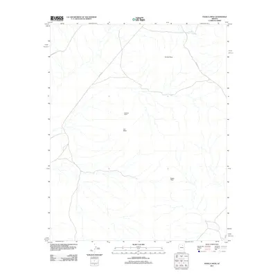
2011 Map of Padilla Mesa
USGS Topo · Published 2011About this map
Padilla Mesa and the surrounding high desert terrain in Coconino County are defined by a network of drainage systems and isolated landforms. The topographical prominence of No Trail Mesa and the specific site at Hunters Point reveal a landscape where movement is dictated by the natural rise and fall of the mesas. Transport in this region relies on established corridors such as Indian Rte 3 and Indian Rte 13, which navigate around the prominent Flat Mesa. The inclusion of Red Clay Spring in the northern sector highlights the critical, sparse water sources that have long influenced human presence and cattle movement in this arid environment.
Find a feature on this map
8 named features on this map. Tap any name to fly to it.
Don’t see what you’re looking for? This feature index may not catch every label — zoom into the map to look around manually.
Map Details
Editions of this 2011 Padilla Mesa Map
This is the sole edition of this map. No revisions or reprints were ever made.
Other maps of this area

1883 · Tusayan
USGS Topo · 1:250,000

1886 · Tusayan
USGS Topo · 1:250,000

1947 · Flagstaff
USGS Topo · 1:250,000

1954 · Flagstaff
USGS Topo · 1:250,000

1958 · Flagstaff
USGS Topo · 1:250,000

1960 · Flagstaff
USGS Topo · 1:250,000

1962 · Flagstaff
USGS Topo · 1:250,000

1966 · Oraibi
USGS Topo · 1:62,500

1966 · Tovar Mesa
USGS Topo · 1:62,500
1967 · Sand Springs
USGS Topo · 1:24,000