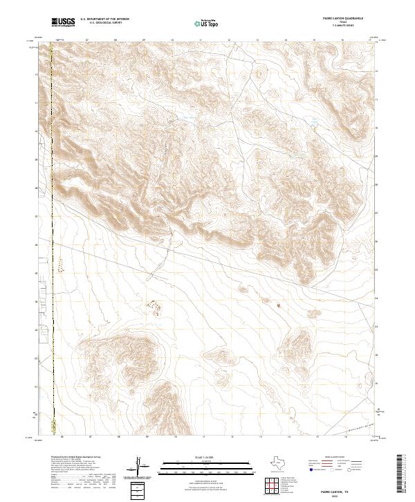
2022 Map of Padre Canyon
USGS Topo · Published 2022About this map
Padre Canyon cuts through the high desert of West Texas, defining the complex topography of this arid corner of Hudspeth County. The landscape is shaped by essential water management features, including several catchment basins such as Owl Tanks, Deer Tank, and Quail Tank which support life in this drainage system. These small water sources are critical landmarks in a region dominated by relief and runoff patterns, eventually leading toward Borrego Draw in the southeast. The boundary between El Paso and Hudspeth counties is clearly delineated, showing how political divisions align with this sparsely populated but geographically distinct Chihuahuan Desert environment.
Find a feature on this map
6 named features on this map. Tap any name to fly to it.
Don’t see what you’re looking for? This feature index may not catch every label — zoom into the map to look around manually.
Map Details
Editions of this 2022 Padre Canyon Map
This is the sole edition of this map. No revisions or reprints were ever made.
Other maps of this area

1896 · El Paso
USGS Topo · 1:125,000

1903 · Cerro Alto
USGS Topo · 1:125,000

1908 · El Paso
USGS Topo · 1:125,000

1939 · Heuco Tanks
USGS Topo · 1:62,500

1940 · Heuco Tanks
USGS Topo · 1:62,500

1941 · Clint
USGS Topo · 1:62,500

1941 · Heuco Mountains
USGS Topo · 1:62,500

1942 · Borrego
USGS Topo · 1:62,500

1943 · Heuco Mountains
USGS Topo · 1:62,500

1944 · Heuco Tanks
USGS Topo · 1:62,500