
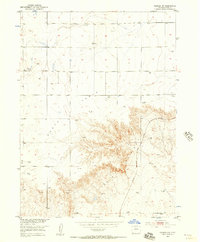
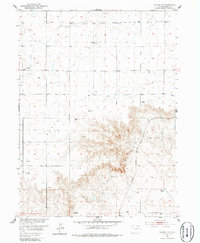
1951 Map of Padroni NW
USGS Topo · Published 1953About this map
Peetz Table dominates the northern landscape of this Logan County quadrangle, where the flat upland abruptly gives way to the deep incisions of Lewis Canyon. This transition from high plains to broken terrain was surveyed in the early 1950s as part of the Missouri River Basin development program. The Chicago Burlington and Quincy railroad cuts through the eastern portion of the map, following the contours of the land near Lewis Creek. Agricultural and industrial life is reflected in the scattered windmills, a silo, and the presence of the Buss Ranch. Subsurface activity is also evident through the Gas Well Tank and Gravel Pit markings, while the VABM 4544 McCrea provides a specific geodetic anchor for the survey. The mapping reveals a sparse but functional network of trails and wells, characteristic of Colorado's high plains ranching economy during this era.
Find a feature on this map
12 named features on this map. Tap any name to fly to it.
Don’t see what you’re looking for? This feature index may not catch every label — zoom into the map to look around manually.
Map Details
Editions of this 1951 Padroni NW Map
3 editions found
Other maps of this area

1951 · Iliff
USGS Topo · 1:24,000

1952 · Padroni
USGS Topo · 1:24,000

1953 · Peetz
USGS Topo · 1:24,000

1954 · Sterling
USGS Topo · 1:250,000

1954 · Scottsbluff
USGS Topo · 1:250,000

1958 · Scottsbluff
USGS Topo · 1:250,000

1958 · Sterling
USGS Topo · 1:250,000

1972 · Easterly Airport
USGS Topo · 1:24,000

1972 · Lorenzo
USGS Topo · 1:24,000

1972 · Potter SE
USGS Topo · 1:24,000