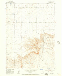
1951 Map of Padroni NW
USGS Topo · Published 1957About this map
Peetz Table dominates the high-plateau geography of Logan County, giving way to the dramatic relief of Lewis Canyon as the landscape descends toward the east. This 1951 survey reveals a remote agricultural and industrial landscape defined by the Chicago Burlington and Quincy railroad line, which skirts the base of the canyon breaks. The distribution of resources is centered on ranching and early energy extraction, evidenced by the Buss Ranch and several Gas Wells and Gravel Pits scattered across the northern sections. Water management in this arid terrain is highly localized, marked by numerous Windmills and isolated Springs that supported livestock. The presence of the VABM McCrea geodetic marker atop the plateau highlights the precision mapping of the Missouri River Basin development program during the early 1950s.
Find a feature on this map
12 named features on this map. Tap any name to fly to it.
Don’t see what you’re looking for? This feature index may not catch every label — zoom into the map to look around manually.
Map Details
Editions of this 1951 Padroni NW Map
3 editions found
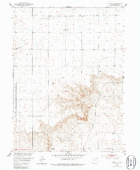
Other maps of this area

1951 · Iliff
USGS Topo · 1:24,000

1951 · Padroni NW
USGS Topo · 1:24,000

1952 · Padroni
USGS Topo · 1:24,000

1953 · Peetz
USGS Topo · 1:24,000

1954 · Sterling
USGS Topo · 1:250,000

1954 · Scottsbluff
USGS Topo · 1:250,000

1958 · Scottsbluff
USGS Topo · 1:250,000

1958 · Sterling
USGS Topo · 1:250,000

1972 · Easterly Airport
USGS Topo · 1:24,000

1972 · Lorenzo
USGS Topo · 1:24,000