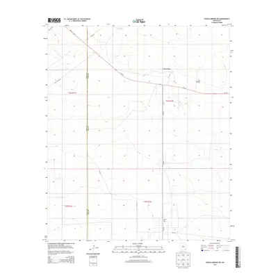
2013 Map of Paduca Breaks NW
USGS Topo · Published 2013About this map
Cotton Place occupies the high ground of the High Plains in this 2013 survey, where the arid landscape is defined by its industrial energy footprint. The map documents a sparsely populated but active region along the Eddy Co Lea Co line, characterized by its reliance on isolated water sources like Jack Tank. The energy economy is the primary driver of development here, evident in the extensive operations at the Double X Oil Field and the Paduca Oil Field. Transport across these desert flats relies on a network of straight-line thoroughfares such as NM-128, Orla Rd, and Buck Jackson Rd, which connect the scattered extraction sites and ranching outposts. The survey provides a clear view of the cadastral grid and terrain variations across the T24S and T25S townships during a period of modern resource management.
Find a feature on this map
16 named features on this map. Tap any name to fly to it.
Don’t see what you’re looking for? This feature index may not catch every label — zoom into the map to look around manually.
Map Details
Editions of this 2013 Paduca Breaks NW Map
This is the sole edition of this map. No revisions or reprints were ever made.
Other maps of this area

1939 · Nash Draw
USGS Topo · 1:62,500

1943 · Nash Draw
USGS Topo · 1:62,500

1954 · Hobbs
USGS Topo · 1:250,000

1958 · Hobbs
USGS Topo · 1:250,000

1963 · Hat Mesa
USGS Topo · 1:62,500

1968 · Phantom Banks
USGS Topo · 1:24,000
1968 · Big Sinks
USGS Topo · 1:24,000

1973 · Bell Lake
USGS Topo · 1:24,000

1973 · Paduca Breaks NW
USGS Topo · 1:24,000

1973 · Paduca Breaks East
USGS Topo · 1:24,000