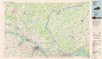
1984 Map of Paducah
USGS Topo · Published 1986About this map
The confluence of the Ohio River, Tennessee River, and Cumberland River anchors this regional study of the western Kentucky and southern Illinois borderlands. In the mid-1980s, the landscape is defined by its massive water management projects and timbered tracts, notably the Land Between The Lakes recreation area situated between Kentucky Lake and Lake Barkley. Industrial and transport nodes like Paducah and Metropolis contrast with the dense woodlands of the Shawnee National Forest, while the Kentucky State Penitentiary stands prominently on the shores of Lake Barkley near Eddyville.
Find a feature on this map
148 named features on this map. Tap any name to fly to it.
Don’t see what you’re looking for? This feature index may not catch every label — zoom into the map to look around manually.
Map Details
Editions of this 1984 Paducah Map
This is the sole edition of this map. No revisions or reprints were ever made.
Other maps of this area

1907 · Morganfield
USGS Topo · 1:62,500

1908 · Princeton
USGS Topo · 1:62,500

1909 · Providence
USGS Topo · 1:62,500

1910 · Princeton
USGS Topo · 1:62,500

1916 · Shawneetown
USGS Topo · 1:62,500

1916 · Fords Ferry
USGS Topo · 1:62,500

1916 · Golconda
USGS Topo · 1:62,500

1916 · Equality
USGS Topo · 1:62,500

1917 · Brownfield
USGS Topo · 1:62,500

1918 · Vienna
USGS Topo · 1:62,500