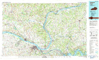
1986 Map of Paducah
USGS Topo · Published 1987About this map
The confluence of the Ohio River, Tennessee River, and Cumberland River dominates this mid-1980s landscape, illustrating a region shaped by major twentieth-century hydraulic engineering. From the industrial hub of Paducah to the riverside town of Metropolis, the map traces the critical infrastructure of the river economy, including the Smithland Locks and Dam and the massive impoundments of Kentucky Lake and Lake Barkley created by the Kentucky Dam and Barkley Dam.
Find a feature on this map
185 named features on this map. Tap any name to fly to it.
Don’t see what you’re looking for? This feature index may not catch every label — zoom into the map to look around manually.
Map Details
Editions of this 1986 Paducah Map
This is the sole edition of this map. No revisions or reprints were ever made.
Other maps of this area

1907 · Morganfield
USGS Topo · 1:62,500

1908 · Princeton
USGS Topo · 1:62,500

1909 · Providence
USGS Topo · 1:62,500

1910 · Princeton
USGS Topo · 1:62,500

1916 · Shawneetown
USGS Topo · 1:62,500

1916 · Fords Ferry
USGS Topo · 1:62,500

1916 · Golconda
USGS Topo · 1:62,500

1916 · Equality
USGS Topo · 1:62,500

1917 · Brownfield
USGS Topo · 1:62,500

1918 · Vienna
USGS Topo · 1:62,500