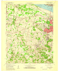
1958 Map of Paducah West
USGS Topo · Published 1959About this map
The Ohio River forms the northern boundary of this landscape where western Kentucky meets southern Illinois. Significant mid-century infrastructure defines the riverfront, including the Irvin S Cobb Bridge connecting Paducah to Brookport. The city’s westward expansion is evident in neighborhoods like Avondale Heights and Forest Hill, while further out, rural communities such as Lone Oak and West Paducah maintain a distinct identity tied to the surrounding farmland.
Find a feature on this map
62 named features on this map. Tap any name to fly to it.
Don’t see what you’re looking for? This feature index may not catch every label — zoom into the map to look around manually.
Map Details
Editions of this 1958 Paducah West Map
2 editions found
Other maps of this area

1926 · Paducah
USGS Topo · 1:62,500

1928 · La Center
USGS Topo · 1:62,500

1929 · Paducah
USGS Topo · 1:62,500

1932 · La Center
USGS Topo · 1:62,500

1936 · Melber
USGS Topo · 1:24,000

1936 · Paducah
USGS Topo · 1:24,000

1936 · Symsonia
USGS Topo · 1:24,000

1940 · Paducah
USGS Topo · 1:62,500

1949 · Paducah
USGS Topo · 1:250,000

1950 · Paducah
USGS Topo · 1:250,000