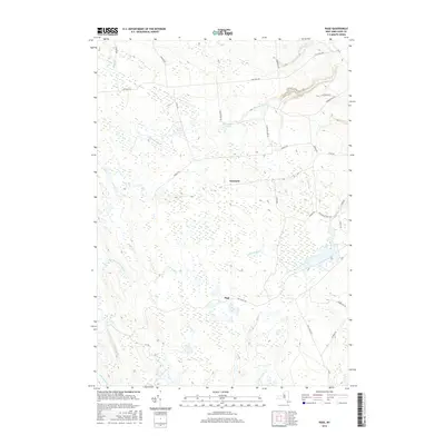
2016 Map of Page
USGS Topo · Published 2016About this map
Wetmore and Page anchor this section of the Tug Hill Plateau, a landscape defined by an intricate network of headwater streams and wetlands. The drainage patterns are clearly visible through the winding courses of Roaring Brook in the north and the East Branch Fish Creek system to the southwest. This era of the landscape is characterized by a mix of local thoroughfares like Flat Rock RD and utility corridors such as the Dec Truck Trl, reflecting the region's managed forests and rural character. To the east, the terrain rises toward Gomer Hill Rd, while numerous water bodies like Haber Pond and Alexander Pond dot the high ground between Atwater Cr and Whetstone Cr. The map provides a detailed view of the remote road network, including Graves RD and Houseville Gulf RD, which connect these small settlements across the marshy uplands of Lewis County.
Find a feature on this map
36 named features on this map. Tap any name to fly to it.
Don’t see what you’re looking for? This feature index may not catch every label — zoom into the map to look around manually.
Map Details
Editions of this 2016 Page Map
This is the sole edition of this map. No revisions or reprints were ever made.
Other maps of this area

1902 · Carthage
USGS Topo · 1:62,500

1904 · Carthage
USGS Topo · 1:62,500

1905 · Port Leyden
USGS Topo · 1:62,500

1906 · Highmarket
USGS Topo · 1:62,500

1907 · Port Leyden
USGS Topo · 1:62,500

1911 · Lowville
USGS Topo · 1:62,500

1913 · Lowville
USGS Topo · 1:62,500

1940 · Port Leyden
USGS Topo · 1:62,500
1943 · New Boston
USGS Topo · 1:31,680

1943 · West Lowville
USGS Topo · 1:31,680