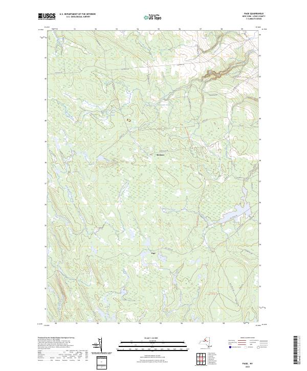
2023 Map of Page
USGS Topo · Published 2023About this map
Page and Wetmore anchor this upland portion of Lewis County, where the landscape is defined by the headwaters of the East Branch Fish Creek and its many tributaries. The area is characterized by an extensive network of service routes and trails, including the DEC Truck Trl and No 9 Truck Trl, which navigate the dense woods and wetlands between Pringle Creek and Whetstone Creek. This terrain reflects the region's history as a managed forest and water source, with numerous small bodies of water like Alexander Pond and Haber Pond scattered throughout the northern reaches. Settlement is sparse, concentrated primarily along established thoroughfares like Gomer Hill Rd and Houseville Gulf Rd, indicating a transition from the cleared agricultural lands of the Black River valley to the deeper Adirondack foothills.
Find a feature on this map
40 named features on this map. Tap any name to fly to it.
Don’t see what you’re looking for? This feature index may not catch every label — zoom into the map to look around manually.
Map Details
Editions of this 2023 Page Map
This is the sole edition of this map. No revisions or reprints were ever made.
Other maps of this area

1902 · Carthage
USGS Topo · 1:62,500

1904 · Carthage
USGS Topo · 1:62,500

1905 · Port Leyden
USGS Topo · 1:62,500

1906 · Highmarket
USGS Topo · 1:62,500

1907 · Port Leyden
USGS Topo · 1:62,500

1911 · Lowville
USGS Topo · 1:62,500

1913 · Lowville
USGS Topo · 1:62,500

1940 · Port Leyden
USGS Topo · 1:62,500
1943 · New Boston
USGS Topo · 1:31,680

1943 · West Lowville
USGS Topo · 1:31,680