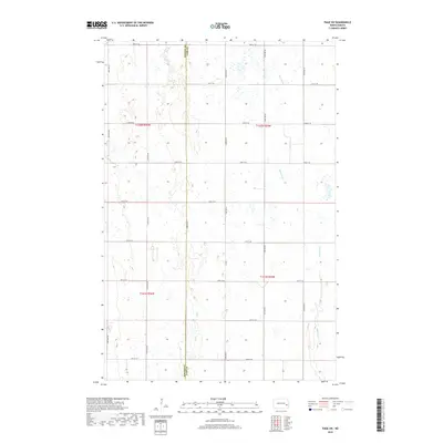
2018 Map of Page SW
USGS Topo · Published 2018About this map
The Maple River meanders through the eastern section of this North Dakota landscape, carving a subtle path through the glacial terrain on the border of Barnes Co and Cass Co. This survey illustrates a meticulously organized agricultural grid, where section lines are defined by local routes such as 130th Ave SE and 133rd Ave SE. The intersection of these county roads and the river's path reveals a rural infrastructure built around the township-and-range system, specifically covering parts of t142n r56w and t141n r55w. While the terrain is dominated by small wetlands and depressions typical of the prairie pothole region, human activity is concentrated along the arterial Co Rd 1 and the named section roads that facilitate movement across the sprawling fields of the Red River Valley hinterlands.
Find a feature on this map
22 named features on this map. Tap any name to fly to it.
Don’t see what you’re looking for? This feature index may not catch every label — zoom into the map to look around manually.
Map Details
Editions of this 2018 Page SW Map
This is the sole edition of this map. No revisions or reprints were ever made.
Other maps of this area

1897 · Tower
USGS Topo · 1:125,000

1952 · Grand Forks
USGS Topo · 1:250,000

1953 · Fargo
USGS Topo · 1:250,000

1956 · Fargo
USGS Topo · 1:250,000

1956 · Grand Forks
USGS Topo · 1:250,000

1966 · Grand Forks
USGS Topo · 1:250,000

1967 · Tower City
USGS Topo · 1:24,000

1967 · Pillsbury SE
USGS Topo · 1:24,000

1967 · Page SE
USGS Topo · 1:24,000

1967 · Page
USGS Topo · 1:24,000