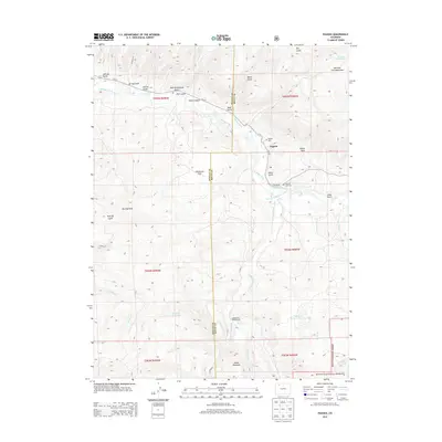
2013 Map of Pagoda
USGS Topo · Published 2013About this map
The Williams Fork river system carves through the landscape of northwestern Colorado on this 2013 survey, where the border of Moffat and Routt Counties meets among the ridges and gulches. The small settlement of Pagoda serves as a local landmark, anchored by the Pagoda Cem and the Buckner Hart Cem nearby. The terrain is defined by dramatic elevation changes, ranging from the heights of Daton Peak and the Williams Fork Mountains to the level expanse of Oklahoma Flat. Water management is central to the area's geography, evidenced by the Peck Ditch, Highland Ditch, and Sullivan Ditch, alongside multiple catchment points like Sagebrush Reservoir Number 1 and Saddle Reservoir. To the south, the boundary of the Routt National Forest encompasses the Indian Run Campground and the prominent Round Mountain.
Find a feature on this map
51 named features on this map. Tap any name to fly to it.
Don’t see what you’re looking for? This feature index may not catch every label — zoom into the map to look around manually.
Map Details
Editions of this 2013 Pagoda Map
This is the sole edition of this map. No revisions or reprints were ever made.
Other maps of this area

1910 · Danforth Hills
USGS Topo · 1:125,000

1915 · Monument Butte
USGS Topo · 1:62,500

1916 · Daton Peak
USGS Topo · 1:62,500

1920 · Daton Peak
USGS Topo · 1:62,500

1954 · Craig
USGS Topo · 1:250,000

1957 · Craig
USGS Topo · 1:250,000

1958 · Craig
USGS Topo · 1:250,000

1960 · Craig
USGS Topo · 1:250,000

1962 · Craig
USGS Topo · 1:250,000

1964 · Craig
USGS Topo · 1:250,000