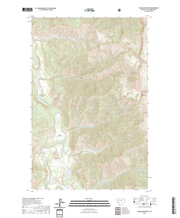
2024 Map of Pagoda Mountain
USGS Topo · Published 2024About this map
The Flathead Wild and Scenic River defines the western corridor of this mountain landscape, following the South Fork Flathead River as it winds through protected backcountry. Located within the Flathead National Forest and the Bob Marshall Wilderness, the area is characterized by high-elevation peaks such as Pagoda Mtn and Helen Mtn, and significant watercourses like Damnation Creek and Little Salmon Creek. Historical access is preserved through a network of established paths, including the Black Bear Bridge Ford Trl and the Old Forks Ford Trl, which provide vital crossings in this roadless terrain. Features like Independence Park and Little Salmon Park are situated along the river banks, while Solitude Point and Cone Peak offer distinct navigational landmarks for those traversing the high ridges between drainage basins.
Find a feature on this map
33 named features on this map. Tap any name to fly to it.
Don’t see what you’re looking for? This feature index may not catch every label — zoom into the map to look around manually.
Map Details
Editions of this 2024 Pagoda Mountain Map
This is the sole edition of this map. No revisions or reprints were ever made.
Other maps of this area

1936 · Silvertip
USGS Topo · 1:96,000

1942 · Silvertip
USGS Topo · 1:125,000

1955 · Choteau
USGS Topo · 1:250,000

1957 · Choteau
USGS Topo · 1:250,000

1958 · Choteau
USGS Topo · 1:250,000

1962 · Choteau
USGS Topo · 1:250,000

1970 · Big Salmon Lake East
USGS Topo · 1:24,000
1970 · Cathedral Peak
USGS Topo · 1:24,000
1970 · Marmot Mountain
USGS Topo · 1:24,000
1970 · Haystack Mountain
USGS Topo · 1:24,000