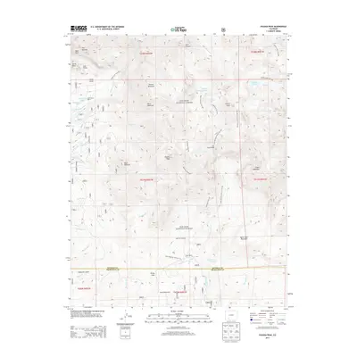
2013 Map of Pagosa Peak
USGS Topo · Published 2013About this map
Pagosa Peak dominates the center of this high-elevation terrain within the San Juan National Forest, where the boundary between Mineral and Archuleta counties crosses a landscape defined by dramatic peaks and alpine hydrology. Established ranching outposts like Minor Notch Ranch and Cade Ranch sit near the margins of the forest, while an intricate network of water management and transit routes, including the Piedra Falls Ditch and the Fourmile Stock Drive Trail, indicate the historical intersection of agriculture and wilderness management. The presence of The Steel Bridge near Falls Creek and the Fourmile Trailhead highlight the area's development for backcountry access. Natural landmarks such as The Keyhole, Monk Rock, and Lost Valley suggest a geologically complex environment that has long served as a waypoint for travelers moving through Windy Pass.
Find a feature on this map
59 named features on this map. Tap any name to fly to it.
Don’t see what you’re looking for? This feature index may not catch every label — zoom into the map to look around manually.
Map Details
Editions of this 2013 Pagosa Peak Map
This is the sole edition of this map. No revisions or reprints were ever made.
Other maps of this area

1905 · San Cristobal
USGS Topo · 1:125,000

1907 · San Cristobal
USGS Topo · 1:125,000

1913 · Summitville
USGS Topo · 1:125,000

1914 · Creede
USGS Topo · 1:125,000

1915 · Summitville
USGS Topo · 1:125,000

1916 · Creede
USGS Topo · 1:125,000

1924 · Pagosa Springs
USGS Topo · 1:125,000

1927 · Pagosa Springs
USGS Topo · 1:125,000

1945 · Durango
USGS Topo · 1:250,000

1953 · Durango
USGS Topo · 1:250,000