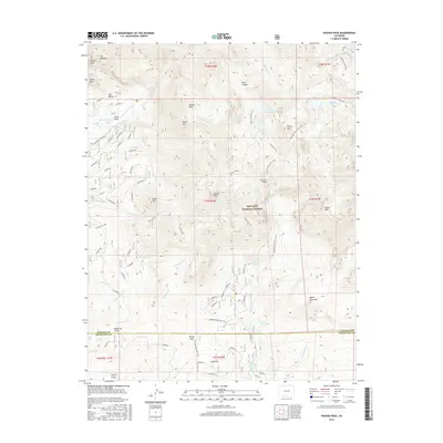
2016 Map of Pagosa Peak
USGS Topo · Published 2016About this map
Pagosa Peak dominates this high-altitude landscape within the San Juan National Forest, where the border of Mineral and Archuleta counties meets. The map illustrates a complex network of water management and alpine drainage, featuring the Piedra Falls Ditch and Dutton Ditch alongside natural features like Upper Fourmile Lake and Rainbow Lake. Evidence of human passage through this high country is marked by the Fourmile Stock Drive Trail and the notable Steel Bridge spanning a local drainage.
Find a feature on this map
55 named features on this map. Tap any name to fly to it.
Don’t see what you’re looking for? This feature index may not catch every label — zoom into the map to look around manually.
Map Details
Editions of this 2016 Pagosa Peak Map
This is the sole edition of this map. No revisions or reprints were ever made.
Other maps of this area

1905 · San Cristobal
USGS Topo · 1:125,000

1907 · San Cristobal
USGS Topo · 1:125,000

1913 · Summitville
USGS Topo · 1:125,000

1914 · Creede
USGS Topo · 1:125,000

1915 · Summitville
USGS Topo · 1:125,000

1916 · Creede
USGS Topo · 1:125,000

1924 · Pagosa Springs
USGS Topo · 1:125,000

1927 · Pagosa Springs
USGS Topo · 1:125,000

1945 · Durango
USGS Topo · 1:250,000

1953 · Durango
USGS Topo · 1:250,000