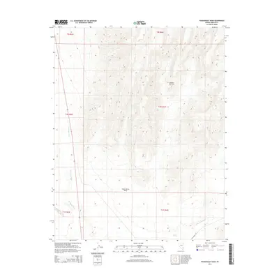
2014 Map of Pahranagat Wash
USGS Topo · Published 2014About this map
Pahranagat Wash flows through this desert landscape in Lincoln County, defining the drainage patterns of the high arid basins. The terrain is dominated by the steep slopes of the Delamar Mountains to the northeast, which give way to the relatively level floor of the Coyote Spring Valley. The convergence of these geological features highlights the natural corridor used by modern infrastructure, including the highway marked 93. In the southern portion of the map, Coyote Springs marks a vital water source in this dry environment near the junction of the Kane Springs Wash. The map reveals how the sparse network of desert roads, such as Kane Springs Rd, follows the natural contours of the washes and valleys, illustrating the persistent influence of topography on travel in the Nevada backcountry.
Find a feature on this map
13 named features on this map. Tap any name to fly to it.
Don’t see what you’re looking for? This feature index may not catch every label — zoom into the map to look around manually.
Map Details
Editions of this 2014 Pahranagat Wash Map
This is the sole edition of this map. No revisions or reprints were ever made.
Other maps of this area

1885 · Pioche
USGS Topo · 1:250,000

1886 · Saint Thomas
USGS Topo · 1:250,000

1886 · Pioche
USGS Topo · 1:250,000

1893 · Saint Thomas
USGS Topo · 1:250,000

1907 · Las Vegas
USGS Topo · 1:250,000

1908 · Las Vegas
USGS Topo · 1:250,000

1945 · Sheep Range
USGS Topo · 1:125,000

1945 · Alamo
USGS Topo · 1:125,000

1954 · Caliente
USGS Topo · 1:250,000

1954 · Las Vegas
USGS Topo · 1:250,000