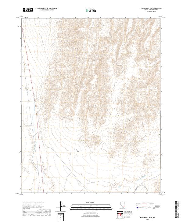
2021 Map of Pahranagat Wash
USGS Topo · Published 2021About this map
Coyote Spring Valley dominates this stretch of the Nevada desert, where the arid basin floor meets the rising slopes of the Delamar Mountains. The landscape is defined by the drainage networks of Pahranagat Wash and Kane Springs Wash, which reveal the hydrological patterns of Lincoln County. Modern infrastructure like Highway 93 and the historic Kane Springs Rd navigate the valley floor, providing access to the remote settlement of Coyote Springs. The map illustrates the intersection of public land survey sections and the expansive natural washes that have long served as corridors through the high desert terrain. This 2021 survey provides a high-resolution view of how transportation and sparse settlement have adapted to the alluvial fans and ridgelines of the region.
Find a feature on this map
13 named features on this map. Tap any name to fly to it.
Don’t see what you’re looking for? This feature index may not catch every label — zoom into the map to look around manually.
Map Details
Editions of this 2021 Pahranagat Wash Map
This is the sole edition of this map. No revisions or reprints were ever made.
Other maps of this area

1885 · Pioche
USGS Topo · 1:250,000

1886 · Saint Thomas
USGS Topo · 1:250,000

1886 · Pioche
USGS Topo · 1:250,000

1893 · Saint Thomas
USGS Topo · 1:250,000

1907 · Las Vegas
USGS Topo · 1:250,000

1908 · Las Vegas
USGS Topo · 1:250,000

1945 · Sheep Range
USGS Topo · 1:125,000

1945 · Alamo
USGS Topo · 1:125,000

1954 · Caliente
USGS Topo · 1:250,000

1954 · Las Vegas
USGS Topo · 1:250,000