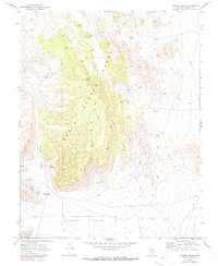
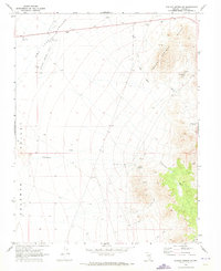
1970 Map of Pahroc Spring
USGS Topo · Published 1990About this map
The North Pahroc Range dominates this landscape, its steep topography giving way to the broad Pahroc Valley to the south. Life and navigation in this desert environment are defined by critical water sources, including the namesake Pahroc Spring, Mustang Spring, and Little Boulder Spring. These isolated springs and associated corrals indicate the area's use for ranching, while a Water Tank and several aqueducts reveal the engineered efforts to manage water resources across the basin. Movement through the difficult terrain is largely restricted to primitive Jeep Trails that skirt the edges of Pahroc Canyon and cross the alluvial fan of Boulder Wash. This 1970 survey, based on aerial photography from the late 1960s, documents a remote Lincoln County corner focused on resource management and livestock long before modern development altered the region.
Find a feature on this map
13 named features on this map. Tap any name to fly to it.
Don’t see what you’re looking for? This feature index may not catch every label — zoom into the map to look around manually.
Map Details
Editions of this 1970 Pahroc Spring Map
2 editions found
Other maps of this area

1885 · Pioche
USGS Topo · 1:250,000

1886 · Pioche
USGS Topo · 1:250,000

1954 · Caliente
USGS Topo · 1:250,000

1959 · Caliente
USGS Topo · 1:250,000

1970 · Hiko NE
USGS Topo · 1:24,000
1970 · Pahroc Summit Pass
USGS Topo · 1:24,000

1970 · Hiko SE
USGS Topo · 1:24,000
1970 · Deadman Spring SE
USGS Topo · 1:24,000
1970 · Pahroc Spring SE
USGS Topo · 1:24,000

1970 · Wheatgrass Spring
USGS Topo · 1:24,000