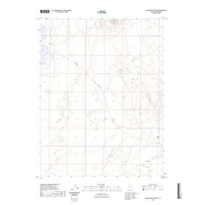
2023 Map of Pahvant Butte South
USGS Topo · Published 2023About this map
Clear Lake anchors the western edge of this High Desert landscape, where the waters meet a stark volcanic terrain in Millard County. The map documents a sparsely populated region defined by its geological formations and simple transit corridors. Traces of the area's volcanic past are visible in features like The Cinders and the depression known as Hellhole. The winding path of Clearlake Rd provides the primary access through this territory, leading toward the dramatic contours of Devils Kitchen. This 2023 survey by the U.S. Geological Survey captures the modern state of these ancient formations, offering a precise look at the land's relief and the sparse infrastructure that navigates it.
Find a feature on this map
5 named features on this map. Tap any name to fly to it.
Don’t see what you’re looking for? This feature index may not catch every label — zoom into the map to look around manually.
Map Details
Editions of this 2023 Pahvant Butte South Map
This is the sole edition of this map. No revisions or reprints were ever made.
Other maps of this area

1885 · Beaver
USGS Topo · 1:250,000

1885 · Sevier Desert
USGS Topo · 1:250,000

1953 · Richfield
USGS Topo · 1:250,000

1953 · Delta
USGS Topo · 1:250,000

1958 · Richfield
USGS Topo · 1:250,000

1958 · Delta
USGS Topo · 1:250,000

1960 · Meadow
USGS Topo · 1:24,000

1962 · Delta
USGS Topo · 1:250,000

1962 · Fillmore
USGS Topo · 1:62,500
1962 · The Sink
USGS Topo · 1:24,000