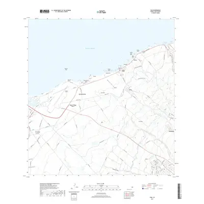
2017 Map of Paia
USGS Topo · Published 2017About this map
The coastal community of Pāʻia serves as a focal point along the northern shore of Maui in this 2017 survey. The landscape reflects a transition from the maritime activity at Kuʻau Bay and Māliko Bay to the inland agricultural and residential developments of Haliimaile and Puʻunēnē. The presence of the Hamakua Ditch and Lowrie Ditch systems highlights the island's complex water management history, essential for the sugarcane industry that once defined this region.
Find a feature on this map
101 named features on this map. Tap any name to fly to it.
Don’t see what you’re looking for? This feature index may not catch every label — zoom into the map to look around manually.
Map Details
Editions of this 2017 Paia Map
This is the sole edition of this map. No revisions or reprints were ever made.
Other maps of this area

1954 · Maui
USGS Topo · 1:250,000

1954 · Maalaea
USGS Topo · 1:24,000

1954 · Paia
USGS Topo · 1:24,000

1954 · Puu O Kali
USGS Topo · 1:24,000

1955 · Wailuku
USGS Topo · 1:24,000

1955 · Kahakuloa
USGS Topo · 1:24,000

1957 · Kilohana
USGS Topo · 1:24,000

1957 · Haiku
USGS Topo · 1:24,000

1966 · Maui
USGS Topo · 1:250,000

1974 · Maui
USGS Topo · 1:250,000