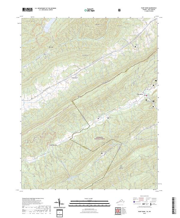
2022 Map of Paint Bank
USGS Topo · Published 2022About this map
Paint Bank serves as a primary point of reference in this Appalachian landscape, where the state line between Virginia and West Virginia follows the high ridges of Peters Mountain. This 2022 survey details the complex terrain of the Jefferson National Forest, including numerous family burial sites like the Tingler Family Cem and Linton Family Cem that reflect the deep-rooted local genealogy of the region. The map highlights a network of water sources vital to the area's development, including the Charles Patton Spring and the Left Fork Trout Branch Springs. Transportation routes such as the Waiteville Rd and Allegheny Trl navigate the gaps between Potts Mountain and Little Mtn, connecting small settlements like Roxalia and Centennial across the county line of Craig Co and Monroe Co.
Find a feature on this map
65 named features on this map. Tap any name to fly to it.
Don’t see what you’re looking for? This feature index may not catch every label — zoom into the map to look around manually.
Map Details
Editions of this 2022 Paint Bank Map
This is the sole edition of this map. No revisions or reprints were ever made.
Other maps of this area

1887 · Lewisburg
USGS Topo · 1:125,000

1890 · Christiansburg
USGS Topo · 1:125,000

1891 · Lewisburg
USGS Topo · 1:125,000

1921 · Ronceverte
USGS Topo · 1:48,000

1923 · Ronceverte
USGS Topo · 1:62,500

1923 · Waiteville
USGS Topo · 1:62,500

1929 · Salem
USGS Topo · 1:48,000

1931 · Waiteville
USGS Topo · 1:48,000

1932 · Salem
USGS Topo · 1:62,500

1944 · Waiteville
USGS Topo · 1:62,500