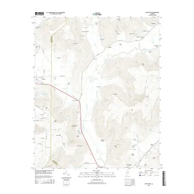
2014 Map of Paint Rock
USGS Topo · Published 2014About this map
The Paint Rock River carves a deep valley through the limestone topography of northeast Alabama, anchoring a series of small settlements along the Us 72 and Al 65 corridors. At this point in the early 21st century, the landscape is defined by the steep-walled coves and hollows that branch away from the main river valley, such as Bingham Cove and Killingsworth Cove. Local history is preserved in numerous family and community burial grounds, including the Rousseau Cem and Latham Cem, which are tucked away in the upland hollows. The transition from the plateau heights of Gurley Mtn and Splitrock Mtn to the fertile bottomlands of Paint Rock Valley illustrates the classic settlement patterns of the region, where roads and towns like Gurley and Paint Rock follow the more navigable lowlands.
Find a feature on this map
110 named features on this map. Tap any name to fly to it.
Don’t see what you’re looking for? This feature index may not catch every label — zoom into the map to look around manually.
Map Details
Editions of this 2014 Paint Rock Map
This is the sole edition of this map. No revisions or reprints were ever made.
Other maps of this area

1888 · Scottsboro
USGS Topo · 1:125,000

1892 · Scottsboro
USGS Topo · 1:125,000

1936 · New Hope
USGS Topo · 1:24,000

1936 · Moontown
USGS Topo · 1:24,000

1936 · Hollytree
USGS Topo · 1:24,000

1936 · Grant
USGS Topo · 1:24,000

1936 · Princeton
USGS Topo · 1:24,000

1936 · Lim Rock
USGS Topo · 1:24,000

1936 · Maysville
USGS Topo · 1:24,000
1936 · Swearengin
USGS Topo · 1:24,000