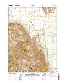
2014 Map of Paisley
USGS Topo · Published 2014About this map
Paisley sits as the central hub of this high-desert basin, where the Chewaucan River flows from the steep timbered slopes of the Fremont National Forest into a complex network of agricultural irrigation. The landscape transitions sharply from the elevated terrain of Ten Mile Butte and Fir Timber Butte down to the Paisley Flat. This 2014 survey documents a sophisticated water management system vital to local ranching, including the Admans Mill Pond, Fisher Slough, and numerous man-made channels like the Red House Ditch and Jones Canal. South of the main settlement, the land gives way to the Upper Chewaucan Marsh, while the western hills hide Twin Lakes and the drainage of Sage Hen Cr. The map details the rural infrastructure connecting these points, from the Fremont Hwy to remote timber access routes like Natl Forest Develop Road 330 Rd.
Find a feature on this map
46 named features on this map. Tap any name to fly to it.
Don’t see what you’re looking for? This feature index may not catch every label — zoom into the map to look around manually.
Map Details
Editions of this 2014 Paisley Map
This is the sole edition of this map. No revisions or reprints were ever made.
Other maps of this area

1955 · Klamath Falls
USGS Topo · 1:250,000

1958 · Klamath Falls
USGS Topo · 1:250,000

1966 · Morgan Butte
USGS Topo · 1:24,000

1966 · Tucker Hill
USGS Topo · 1:24,000

1966 · Slide Mtn
USGS Topo · 1:24,000

1966 · Coglan Buttes
USGS Topo · 1:24,000

1966 · Coffeepot Creek
USGS Topo · 1:24,000

1966 · Paisley
USGS Topo · 1:24,000

1974 · Lake Abert
USGS Topo · 1:100,000

1985 · Sharp Top
USGS Topo · 1:24,000