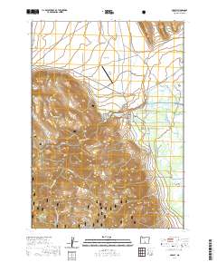
2020 Map of Paisley
USGS Topo · Published 2020About this map
Paisley serves as the central hub of this Lake County landscape, positioned where the high desert of Paisley Flat meets the rising slopes of the Fremont National Forest. The Chewaucan River provides the vital lifeblood for the region, its waters diverted into an intricate network of irrigation channels including the Red House Ditch, ZX Brattain Ditch, and Jones Canal. These man-made waterways support the agricultural character of the valley floor, specifically near the Upper Chewaucan Marsh and Fisher Slough.
Find a feature on this map
35 named features on this map. Tap any name to fly to it.
Don’t see what you’re looking for? This feature index may not catch every label — zoom into the map to look around manually.
Map Details
Editions of this 2020 Paisley Map
This is the sole edition of this map. No revisions or reprints were ever made.
Other maps of this area

1955 · Klamath Falls
USGS Topo · 1:250,000

1958 · Klamath Falls
USGS Topo · 1:250,000

1966 · Morgan Butte
USGS Topo · 1:24,000

1966 · Tucker Hill
USGS Topo · 1:24,000

1966 · Slide Mtn
USGS Topo · 1:24,000

1966 · Coglan Buttes
USGS Topo · 1:24,000

1966 · Coffeepot Creek
USGS Topo · 1:24,000

1966 · Paisley
USGS Topo · 1:24,000

1974 · Lake Abert
USGS Topo · 1:100,000

1985 · Sharp Top
USGS Topo · 1:24,000