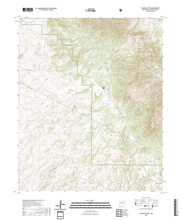
2023 Map of Pajaro Canyon
USGS Topo · Published 2023About this map
Cibola National Forest encompasses the high-altitude terrain of the Gallinas Mountains, where Gallinas Peak and West Turkey Cone dominate the northern skyline. The landscape is defined by its seasonal water management and rugged drainage systems, featuring various catchment points like Pinatosa Tank, Japanese Tank, and North Corn Tank. These tanks and springs, such as Gallinas Spring and Cement Spring, are vital markers of land use in this arid region, providing water for livestock and wildlife across the public lands.
Find a feature on this map
27 named features on this map. Tap any name to fly to it.
Don’t see what you’re looking for? This feature index may not catch every label — zoom into the map to look around manually.
Map Details
Editions of this 2023 Pajaro Canyon Map
This is the sole edition of this map. No revisions or reprints were ever made.
Other maps of this area

1954 · Fort Sumner
USGS Topo · 1:250,000

1958 · Fort Sumner
USGS Topo · 1:250,000

1980 · Corona
USGS Topo · 1:100,000

1981 · Rough Mountain
USGS Topo · 1:24,000
1981 · Progresso SW
USGS Topo · 1:24,000
1981 · Polecat Draw
USGS Topo · 1:24,000
1981 · Pajaro Canyon
USGS Topo · 1:24,000
1981 · Tecolote Peak
USGS Topo · 1:24,000
1981 · Progresso SE
USGS Topo · 1:24,000
1981 · Claunch SE
USGS Topo · 1:24,000