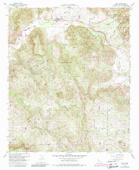
1968 Map of Pala
USGS Topo · Published 1988About this map
The Asistencia de San Antonio de Pala mission sits at the heart of this North San Diego County landscape, serving as a focal point for the Pala Indian Reservation. Following the course of the San Luis Rey River, the topography rises sharply from the river valley into the heights of Pala Mountain and the Cleveland National Forest. This 1968 survey, revised with data through 1988, captures the rural transition of the area, featuring the established Agua Tibia Ranch and the community of Lilac.
Find a feature on this map
48 named features on this map. Tap any name to fly to it.
Don’t see what you’re looking for? This feature index may not catch every label — zoom into the map to look around manually.
Map Details
Editions of this 1968 Pala Map
3 editions found
Other maps of this area

1893 · Escondido
USGS Topo · 1:62,500

1901 · Escondido
USGS Topo · 1:62,500

1901 · San Luis Rey
USGS Topo · 1:125,000

1903 · Ramona
USGS Topo · 1:125,000

1904 · Southern California Sheet No. 2
USGS Topo · 1:250,000

1939 · Palomar Mountain
USGS Topo · 1:62,500

1942 · Temecula
USGS Topo · 1:62,500

1942 · Escondido
USGS Topo · 1:62,500

1942 · Ramona
USGS Topo · 1:62,500

1947 · Ramona
USGS Topo · 1:62,500