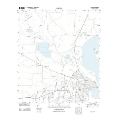
2012 Map of Palatka
USGS Topo · Published 2012About this map
Palatka serves as the focal point of this riverfront survey, positioned where the Saint Johns River narrows significantly. The town's grid expands from the water's edge, supported by the Memorial Bridge and a network of cemeteries such as Saint Joseph Cem and West View Cem that trace the community's lineage. To the northwest, the landscape transitions into a mix of wetlands and rural settlements like Bardin and Springside, where the winding paths of Etonia Cr and Rice Cr define the drainage patterns before they reach the main river channel. Local transit and industry are visible through the presence of the Norfolk Southern railroad line and the Palatka Municipal Airport, which is also identified as Lt. "Kay" Larkin Field. The map captures the city's modern footprint including Saint Johns River Community College and residential developments at Palatka Heights.
Find a feature on this map
130 named features on this map. Tap any name to fly to it.
Don’t see what you’re looking for? This feature index may not catch every label — zoom into the map to look around manually.
Map Details
Editions of this 2012 Palatka Map
This is the sole edition of this map. No revisions or reprints were ever made.
Other maps of this area

1912 · Palatka
USGS Topo · 1:48,000

1915 · Palatka
USGS Topo · 1:62,500

1915 · Interlachen
USGS Topo · 1:48,000

1916 · Interlachen
USGS Topo · 1:62,500

1942 · Ates Creek
USGS Topo · 1:62,500

1944 · Interlachen
USGS Topo · 1:62,500

1947 · Bostwick
USGS Topo · 1:50,000

1949 · Rice Creek
USGS Topo · 1:24,000

1949 · Bostwick
USGS Topo · 1:24,000

1949 · Baywood
USGS Topo · 1:24,000