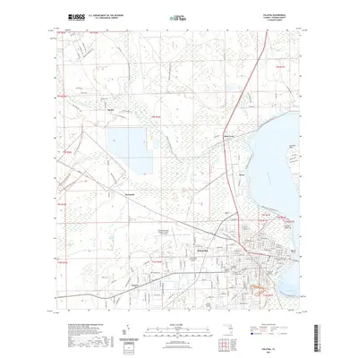
2021 Map of Palatka
USGS Topo · Published 2021About this map
The Saint Johns River defines the eastern edge of this Putnam County landscape, where the city of Palatka serves as a significant riverfront hub. The map reveals a transition from the dense street grid of the city center, anchored by the Putnam County Courthouse, to the surrounding rural settlements of Francis, Bardin, and Springside. To the north, the massive Rice Creek Swamp and the industrial character of Rice Creek contrast with the aviation focus of the Palatka Municipal Airport - Lt Kay Larkin Field.
Find a feature on this map
144 named features on this map. Tap any name to fly to it.
Don’t see what you’re looking for? This feature index may not catch every label — zoom into the map to look around manually.
Map Details
Editions of this 2021 Palatka Map
This is the sole edition of this map. No revisions or reprints were ever made.
Other maps of this area

1912 · Palatka
USGS Topo · 1:48,000

1915 · Palatka
USGS Topo · 1:62,500

1915 · Interlachen
USGS Topo · 1:48,000

1916 · Interlachen
USGS Topo · 1:62,500

1942 · Ates Creek
USGS Topo · 1:62,500

1944 · Interlachen
USGS Topo · 1:62,500

1947 · Bostwick
USGS Topo · 1:50,000

1949 · Rice Creek
USGS Topo · 1:24,000

1949 · Bostwick
USGS Topo · 1:24,000

1949 · Baywood
USGS Topo · 1:24,000