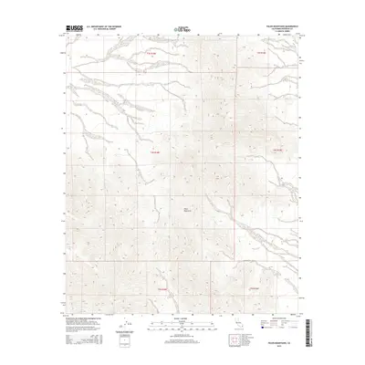
2015 Map of Palen Mountains
USGS Topo · Published 2015About this map
Palen Mountains dominate this 2015 topographic study of the Colorado Desert in Riverside County. The terrain is defined by dramatic elevation changes and a network of ephemeral washes that descend from the steep mountain ridges into the surrounding basins. This map focuses on a largely uninhabited and undisturbed desert landscape, providing a high-resolution view of the natural topography. The survey is meticulously partitioned by the Public Land Survey System, showing the township and range boundaries for t3s r18e, t4s r18e, and t5s r18e, along with their eastern counterparts. These grid lines provide the only human-imposed structure on an otherwise wild environment, which remains an essential reference for understanding the physical geography and land management of this remote California desert region.
Find a feature on this map
7 named features on this map. Tap any name to fly to it.
Don’t see what you’re looking for? This feature index may not catch every label — zoom into the map to look around manually.
Map Details
Editions of this 2015 Palen Mountains Map
This is the sole edition of this map. No revisions or reprints were ever made.
Other maps of this area

1942 · Blythe
USGS Topo · 1:250,000

1945 · Midland
USGS Topo · 1:62,500

1952 · Midland
USGS Topo · 1:62,500

1952 · Mc Coy Spring
USGS Topo · 1:62,500

1952 · Sidewinder Well
USGS Topo · 1:62,500

1952 · Palen Mountains
USGS Topo · 1:62,500

1954 · Salton Sea
USGS Topo · 1:250,000

1955 · Salton Sea
USGS Topo · 1:250,000

1959 · Salton Sea
USGS Topo · 1:250,000

1963 · Salton Sea
USGS Topo · 1:250,000