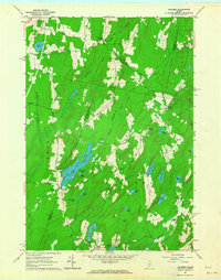
1961 Map of Palermo
USGS Topo · Published 1964About this map
Sheepscot Pond and the winding West Branch Sheepscot River define the watery landscape of this Waldo County interior in the early 1960s. The area is characterized by a dense network of family-named settlements and small rural cemeteries, such as Sennetts Corner and Lincoln Cem, illustrating a long-established pattern of New England farmsteads and timber interests. A notable concentration of glacial ponds, including Dutton Pond, Hackmatack Pond, and Bowler Pond, sit among ridges like Negro Ridge and Osgood Ridge. The presence of the Palermo Sch and various Gravel Pits suggests a local economy tied to school-centered community life and small-scale resource extraction. Researchers will find the detailed mapping of property-line fence and field lines, noted in the margin as visible from 1956 aerial photography, particularly useful for tracing mid-century land use and boundaries.
Find a feature on this map
54 named features on this map. Tap any name to fly to it.
Don’t see what you’re looking for? This feature index may not catch every label — zoom into the map to look around manually.
Map Details
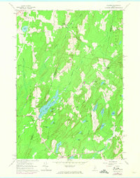
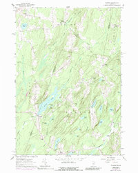
Editions of this 1961 Palermo Map
3 editions found
Other maps of this area

1892 · Waterville
USGS Topo · 1:62,500

1893 · Vassalboro
USGS Topo · 1:62,500

1898 · Vassalboro
USGS Topo · 1:62,500

1916 · Liberty
USGS Topo · 1:62,500

1926 · Burnham
USGS Topo · 1:62,500

1941 · Vassalboro
USGS Topo · 1:62,500

1942 · Liberty
USGS Topo · 1:62,500

1943 · Vassalboro
USGS Topo · 1:62,500

1943 · Waterville
USGS Topo · 1:62,500

1948 · Bangor
USGS Topo · 1:250,000