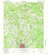
1949 Map of Palestine
USGS Topo · Published 1982About this map
Palestine serves as the bustling hub of Anderson County in the late 1940s, situated at the junction of the Missouri Pacific railroad lines. The surrounding landscape is a dense network of rural communities and educational institutions, featuring sites like Cuney Academy, Union Academy, and the Jerusalem Sch. These small settlements are often centered around local congregations such as Bethel Ch and Concord Ch, providing a clear picture of the social geography of East Texas before mid-century modernization transformed the region.
Find a feature on this map
77 named features on this map. Tap any name to fly to it.
Don’t see what you’re looking for? This feature index may not catch every label — zoom into the map to look around manually.
Map Details
Editions of this 1949 Palestine Map
Other maps of this area

1946 · Bullard
USGS Topo · 1:62,500

1948 · Bullard
USGS Topo · 1:62,500

1949 · Palestine
USGS Topo · 1:62,500

1949 · Frankston
USGS Topo · 1:62,500

1949 · Athens
USGS Topo · 1:62,500

1949 · Tennessee Colony
USGS Topo · 1:62,500

1950 · Athens
USGS Topo · 1:62,500

1950 · Palestine
USGS Topo · 1:62,500

1950 · Frankston
USGS Topo · 1:62,500

1950 · Tennessee Colony
USGS Topo · 1:62,500