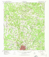
1949 Map of Palestine
USGS Topo · Published 1975About this map
Palestine serves as the primary urban center for this portion of Anderson County, where the Missouri Pacific railroad corridor drives the regional economy. The landscape is dotted with small rural communities and civic institutions, particularly a high density of country churches and early educational sites like Union Academy and Cuney Academy. This 1940s topography captures the area's transition toward modernization, including the presence of the Municipal Airport and several localized water management features like Davey Lake and Upper City Lake. Outside the city center, the terrain is defined by a dense network of creek systems, including Brushy Creek and Keechie Creek, which shaped the placement of earlier settlements like Montalba and Pert. Genealogists will find significant value in the clearly marked family-linked sites, including the Swanson Cem and Coleman Cem, as well as numerous rural congregations such as Watkins Chapel and Broyles Chapel.
Find a feature on this map
68 named features on this map. Tap any name to fly to it.
Don’t see what you’re looking for? This feature index may not catch every label — zoom into the map to look around manually.
Map Details
Editions of this 1949 Palestine Map
Other maps of this area

1946 · Bullard
USGS Topo · 1:62,500

1948 · Bullard
USGS Topo · 1:62,500

1949 · Palestine
USGS Topo · 1:62,500

1949 · Frankston
USGS Topo · 1:62,500

1949 · Athens
USGS Topo · 1:62,500

1949 · Tennessee Colony
USGS Topo · 1:62,500

1950 · Athens
USGS Topo · 1:62,500

1950 · Palestine
USGS Topo · 1:62,500

1950 · Frankston
USGS Topo · 1:62,500

1950 · Tennessee Colony
USGS Topo · 1:62,500