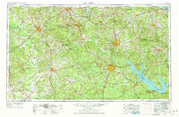
1953 Map of Palestine
USGS Topo · Published 1977About this map
The Trinity River and Neches River systems carve through the East Texas Piney Woods, anchoring a region defined by extensive timberlands and a complex rail network. Major hubs like Palestine, Lufkin, and Nacogdoches serve as centers of industry and transport, connected by the Missouri Pacific RR and Southern Pacific RR. This mid-century revision reflects significant landscape changes, most notably the emergence of massive water projects such as the Toledo Bend Reservoir and Sam Rayburn Lake along the eastern borders.
Find a feature on this map
113 named features on this map. Tap any name to fly to it.
Don’t see what you’re looking for? This feature index may not catch every label — zoom into the map to look around manually.
Map Details
Editions of this 1953 Palestine Map
2 editions found

Other maps of this area

1919 · Fairfield
USGS Topo · 1:62,500

1927 · Lufkin 4-c
USGS Topo · 1:24,000

1928 · Zavalla 3-c
USGS Topo · 1:24,000

1928 · Lufkin 4-d
USGS Topo · 1:24,000

1931 · Zavalla
USGS Topo · 1:62,500

1931 · Iola
USGS Topo · 1:62,500

1932 · Manning
USGS Topo · 1:62,500

1935 · Henderson
USGS Topo · 1:48,000

1937 · Troupe
USGS Topo · 1:48,000

1939 · Henderson
USGS Topo · 1:62,500