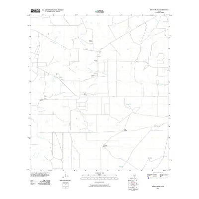
2010 Map of Palito Blanco
USGS Topo · Published 2010About this map
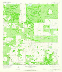
Palito Blanco serves as the focal point for this rural landscape in Jim Wells County, where the topography is defined by the ephemeral drainages of Guajillo Creek, Narciseno Creek, and Santa Gertrudis Creek. The map is particularly notable for its high concentration of family and community burial sites, including Barrera Cemetery, Hinojosa Cemetery, Gonzales Cemetery, Cadenas Cemetery, and Saltiero Cemetery. These sites, often situated near historic landholdings like Saltiero Ranch and La Bandera Ranch, provide a valuable genealogical record of the region's ranching heritage. The infrastructure of the area is geared toward livestock and water management, evidenced by numerous landmarks such as the Rosita Windmill, Lucero Windmill, and Pila Blanca Windmill, alongside essential water catchments like Rosita Tank and Rye Tank.
Find a feature on this map
34 named features on this map. Tap any name to fly to it.
Don’t see what you’re looking for? This feature index may not catch every label — zoom into the map to look around manually.
Map Details
Editions of this 2010 Palito Blanco Map
This is the sole edition of this map. No revisions or reprints were ever made.
Other maps of this area

1917 · Ben Bolt
USGS Topo · 1:62,500

1921 · Falfurrias
USGS Topo · 1:125,000

1956 · Benavides
USGS Topo · 1:62,500

1956 · Laredo
USGS Topo · 1:250,000

1963 · Ben Bolt SE
USGS Topo · 1:24,000

1963 · Ben Bolt NW
USGS Topo · 1:24,000
1963 · Alice South
USGS Topo · 1:24,000
1963 · Palito Blanco
USGS Topo · 1:24,000
1963 · Ella
USGS Topo · 1:24,000
1963 · Seeligson Ranch
USGS Topo · 1:24,000