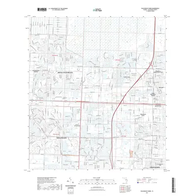
2021 Map of Palm Beach Farms
USGS Topo · Published 2021About this map
Wellington and Royal Palm Beach define this dense landscape of planned communities and water management in the early 21st century. The map reveals the intricate network of residential enclaves, such as Golden Lakes and Lake Belvedere Estates, which are carved out around significant hydrological features like the West Palm Beach Canal and Royal Palm Beach Lake. Educational and civic anchors are prominent, including the Palm Beach Atlantic University Wellington Campus and the Our Lady Queen of Peace Cem. The grid-like expansion of Loxahatchee Groves and Greenacres City highlights the suburban transformation of the interior, while major arteries like Okeechobee Blvd and Southern Blvd serve as the primary conduits for regional movement through these burgeoning Palm Beach County neighborhoods.
Find a feature on this map
24 named features on this map. Tap any name to fly to it.
Don’t see what you’re looking for? This feature index may not catch every label — zoom into the map to look around manually.
Map Details
Editions of this 2021 Palm Beach Farms Map
This is the sole edition of this map. No revisions or reprints were ever made.
Other maps of this area

1945 · Delta
USGS Topo · 1:24,000

1945 · Greenacres City
USGS Topo · 1:24,000

1945 · Lake Worth
USGS Topo · 1:24,000

1946 · Riviera Beach
USGS Topo · 1:24,000

1946 · Palm Beach Farms
USGS Topo · 1:24,000

1946 · Palm Beach
USGS Topo · 1:24,000

1949 · Lake Worth
USGS Topo · 1:24,000

1949 · Palm Beach Farms
USGS Topo · 1:24,000

1949 · Riviera Beach
USGS Topo · 1:24,000

1950 · Greenacres City
USGS Topo · 1:24,000