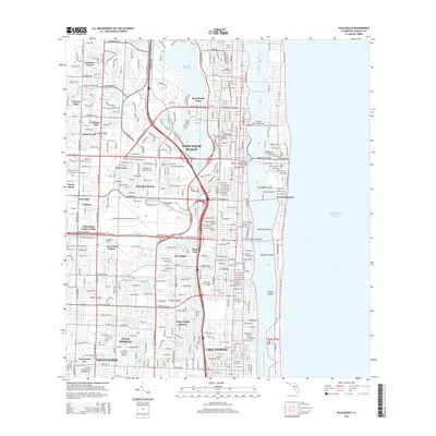
2015 Map of Palm Beach
USGS Topo · Published 2015About this map
West Palm Beach and the exclusive barrier island of Palm Beach dominate this detailed 2015 perspective of the Florida coast. The dense urban grid is defined by its relation to the Intracoastal Waterway and the Lake Worth lagoon, spanning the water via the Flagler Memorial Bridge, Royal Palm Bridge, and Southern Boulevard Bridge. This period shows the fully integrated footprint of the Palm Beach International Airport and the suburban expansion of communities like Lake Clarke Shores and Palm Springs.
Find a feature on this map
54 named features on this map. Tap any name to fly to it.
Don’t see what you’re looking for? This feature index may not catch every label — zoom into the map to look around manually.
Map Details
Editions of this 2015 Palm Beach Map
This is the sole edition of this map. No revisions or reprints were ever made.
Other maps of this area

1945 · Delta
USGS Topo · 1:24,000

1945 · Greenacres City
USGS Topo · 1:24,000

1945 · Lake Worth
USGS Topo · 1:24,000

1946 · Riviera Beach
USGS Topo · 1:24,000

1946 · Palm Beach Farms
USGS Topo · 1:24,000

1946 · Palm Beach
USGS Topo · 1:24,000

1949 · Lake Worth
USGS Topo · 1:24,000

1949 · Palm Beach Farms
USGS Topo · 1:24,000

1949 · Riviera Beach
USGS Topo · 1:24,000

1950 · Greenacres City
USGS Topo · 1:24,000