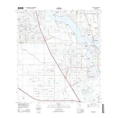
2015 Map of Palm City
USGS Topo · Published 2015About this map
The North Fork Saint Lucie River and South Fork Saint Lucie River converge near Stuart, creating a complex network of points and coves that define the local geography. This 2015 survey captures the intensive residential development and marine-oriented infrastructure of Port Saint Lucie and Palm City, where intricate canal systems like the County Line Canal and Bessy Cr have been integrated into the suburban landscape.
Find a feature on this map
268 named features on this map. Tap any name to fly to it.
Don’t see what you’re looking for? This feature index may not catch every label — zoom into the map to look around manually.
Map Details
Editions of this 2015 Palm City Map
This is the sole edition of this map. No revisions or reprints were ever made.
Other maps of this area

1948 · Palm City
USGS Topo · 1:24,000

1948 · Ankona
USGS Topo · 1:24,000

1948 · St. Lucie Inlet
USGS Topo · 1:24,000

1948 · Gomez
USGS Topo · 1:24,000

1948 · Eden
USGS Topo · 1:24,000

1949 · Gomez
USGS Topo · 1:24,000

1950 · St. Lucie Inlet
USGS Topo · 1:24,000

1950 · Ankona
USGS Topo · 1:24,000

1950 · Palm City
USGS Topo · 1:24,000
1950 · Eden
USGS Topo · 1:24,000